The Øresund Bridge (in Danish: Øresundsbroen, in Swedish: Öresundsbron) is a remarkable engineering achievement, awarded the Outstanding Structure Award in 2002. It connects Copenhagen, the capital of Denmark, to Malmö, an important city in Sweden.
A combined road and rail bridge that spans the Øresund Strait for approximately 16 kilometers, its design dates back to 1936. Construction began in 1995 and was completed in 2000, accompanied by the construction of an underwater tunnel, an artificial island, and an artificial peninsula.
Structure and Technical Characteristics
The Øresund Bridge is primarily constructed from steel and prefabricated concrete, with support points elevated above the sea on giant columns. Its construction involved complex underwater work, including the creation of an artificial island called Kastrup and the building of a 2.5-mile-long underwater tunnel.
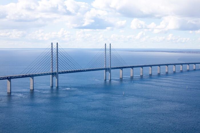
The Øresund Bridge – An Engineering Marvel Connecting Sweden to Denmark
The Øresund Bridge (in Danish: Øresundsbroen, in Swedish: Öresundsbron) is a remarkable engineering achievement, awarded the Outstanding Structure Award in 2002. It connects Copenhagen, the capital of Denmark, to Malmö, an important city in Sweden.
A combined road and rail bridge that spans the Øresund Strait for approximately 16 kilometers, its design dates back to 1936. Construction began in 1995 and was completed in 2000, accompanied by the construction of an underwater tunnel, an artificial island, and an artificial peninsula.
Structure and Technical Characteristics
The Øresund Bridge is primarily constructed from steel and prefabricated concrete, with support points elevated above the sea on giant columns. Its construction involved complex underwater work, including the creation of an artificial island called Kastrup and the building of a 2.5-mile-long underwater tunnel.
The Øresund Bridge consists of three main parts:
-
The Bridge Itself:
- It is a suspended bridge measuring 7.8 kilometers long, including a cable-stayed section with a central span of 490 meters. This is the most impressive and visible part of the structure. The road bridge is situated above the rail bridge, providing four lanes for vehicles and two railway tracks below.
-
The Artificial Island Peberholm:
- This island was built to create a crossing point between the bridge and the tunnel and is located approximately halfway between Sweden and Denmark. Peberholm Island is 4 kilometers long.
-
The Drogden Tunnel:
- The tunnel is located on the Danish side and is 4 kilometers long. It is an underwater tunnel designed to facilitate navigation in the Copenhagen harbor area and minimize environmental impact.
Engineering Challenges and Solutions
-
Stability and Safety: The Øresund Bridge is built in an area exposed to severe weather conditions and heavy maritime traffic. Detailed geological studies and advanced techniques were necessary to ensure the stability of the structure.
-
Environmental Impact: The construction of Peberholm Island was carried out carefully to minimize impact on the marine ecosystem. The island has become an important habitat for local flora and fauna.
-
Navigation: The bridge was designed with sufficient height to allow large vessels to pass underneath, while the underwater tunnel was constructed to provide an unobstructed navigation route.
Economic and Social Importance
The Øresund Bridge has had a major impact on the economy and society of the region:
-
Economic Development: It has facilitated trade and labor mobility between Denmark and Sweden, contributing to the economic growth of both countries.
-
Regional Integration: It has allowed for the creation of an integrated metropolitan region known as the Øresund Region, which has become one of the most dynamic and prosperous areas in Northern Europe.
-
Transport and Tourism: It has significantly improved transport and increased the number of tourists visiting both countries. The Øresund Bridge remains an impressive example of modern engineering and international cooperation, demonstrating how infrastructure can unite nations and stimulate regional development.
You can consult the source of the article here.
Photos sourced from here.